
Difficult to pronounce, but beautiful to look at.
Älgbert Elgson

Dieser Artikel ist auch in Deutsch verfügbar.
Dyrhólaey is probably one of the most beautiful places in Iceland to get to know almost all of the country’s special features within just a few meters. The striking rock is the second southernmost point on the island and owes its name to its shape, which looks like an oversized gate in the middle of the sea and through which boats can even drive. As a frequently depicted motif, Dyrhólaey is known to most Iceland fans and should therefore definitely be included on a trip to Iceland.
The trail of history
Cape Dyrhólaey was formed about 80,000 years ago in a submarine volcanic eruption and over the course of thousands of years, wind and waves formed a large opening in the massive rocky cliff. It is due to this fact that today we also know the rocky cliff as Türlochinsel, or Door Hill Island, even though it is actually not an island, as the impressive cape is connected to the mainland by Road No. 218.

Also worth mentioning historically is the lighthouse on the cape, which was built in 1910 and expanded in 1927. Although it cannot be viewed from the inside, it is a nice photo opportunity and the view is breathtaking even without climbing the tower.
The area near Dyrhólaey has been protected since 1978.
Useful information
Most visitors visit Dyrhólaey either for the breathtakingly beautiful landscape or the feathered inhabitants. Many birds of different species use the rugged cliffs as a nesting place. Particularly popular are the puffins, also known as lundis in Icelandic, which often stay there in large colonies over the summer months and raise their offspring. These fascinating birds, which are somewhat reminiscent of penguins because of their black and white plumage and upright, somewhat clumsy-looking gait, are easy to observe on the Cape.
It is advisable not to get too close to the abyss, which can be up to 120 meters high, as the birds build sheltered burrows in the rocks and the ground could therefore be unstable. Sometimes parts of the rock are blocked off due to dangerous scree slopes, so barriers should not be ignored.
The best view of the nesting birds is along the path that leads from the lower parking lot up to the lighthouse. The path is rocky and should therefore only be attempted with good footwear. There is also a toilet at this lower starting point and the parking lot can be easily reached with a normal vehicle. The unpaved path to the upper parking lot at the lighthouse, however, is only accessible to off-road vehicles.

Dyrhólaey | Auch wenn der Weg steinig und schwer zu sein scheint, so lohnt sich der Ausblick umso mehr. – Even if the path seems rocky and difficult, the view is all the more worthwhile. 
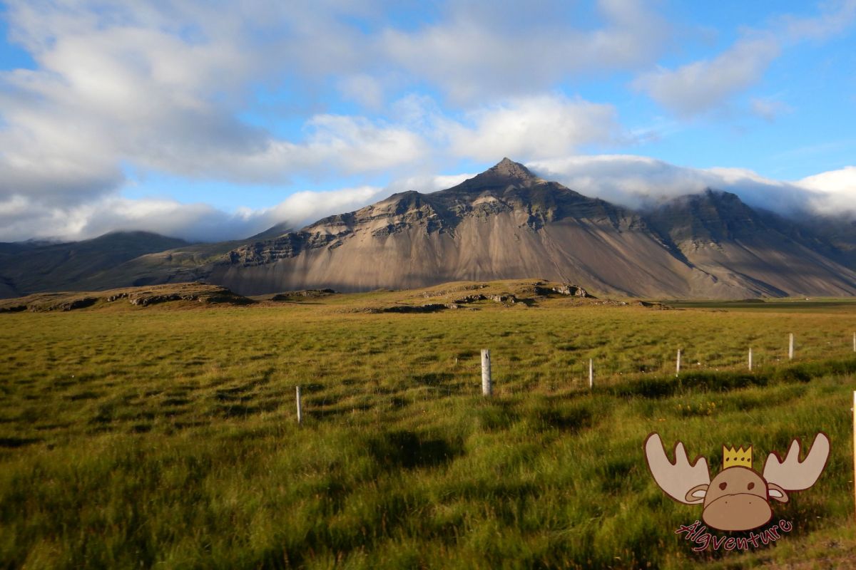
Dyrhólaey | Der Weg zum Leuchtturm führt über einen kleinen Pfad durch grüne Landschaft. – The way to the lighthouse leads over a small path through green landscape 
Dyrhólaey | Älgbert hält nach „Lundis“ Ausschau. Kannst du den Papageientaucher auch sehen? – Älgbert keeps an eye out for „Lundis“. Can you see the puffin too? 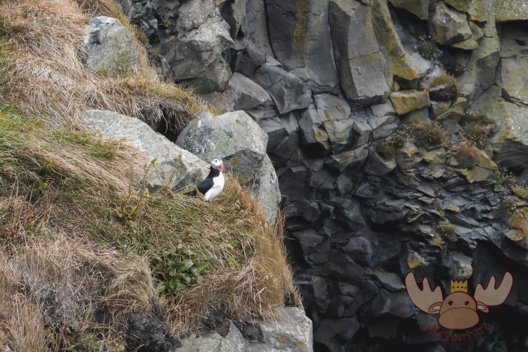
Dyrhólaey | Die Halbinsel ist bekannt für die vielen Brutplätze der Papageientaucher die man mit nur wenigen Metern Entfernung beobachten kann. – The peninsula is known for the many breeding sites of puffins that can be seen from just a few meters away
The view is beautiful from both the upper and lower parking lots. At the lower parking lot you have a great view of the black beach at Reynisfjara and the three striking Reynisdrangar rocks at Vík í Mýrdal. The large eagle rock Arnardrangur, which stands on the edge of the coast and where eagles are said to have once nested, is also impressive.
The upper parking lot is in the immediate vicinity of the lighthouse and offers a fantastic view of the large rock gate and the western black beach of Solheimafjara. This seems to last forever and anyone who appreciates the seemingly deserted nature of Iceland will no longer want to look away.
A visit to the cape is particularly worthwhile during the northern lights season because of the panoramic views.

Dyrhólaey | Die Küste fällt steil hinab zum tosenden Meer – The coast falls steeply down to the raging sea 
Dyrhólaey | Wie überall auf der gesamten isländischen Insel besteht auch die Küste aus vulkanischem Gestein. – Like everywhere else on the entire Icelandic island, the coast consists of volcanic rock. 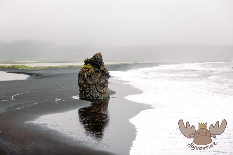
Dyrhólaey | Der gleich nebenan liegende Strand Reynisfjara bietet mit seinem schwarzen Sand im Kontrast zum grünen Hinterland immer wieder schöne Fotomotive. – The Reynisfjara beach, which is right next door, offers beautiful photo opportunities with its black sand in contrast to the green hinterland. 
Dyrhólaey | Endlos wirkende schwarze Sandstrände und (fast) unberührte Landschaft bilden das Panorama auf der Spitze des Berges. – Endless black sandy beaches and (almost) untouched landscape form the panorama on the top of the mountain. 
Dyrhólaey | So viel unberührte Landschaft ist in Europa an kaum einem anderen Ort zu finden als hier in Island. – Hardly anywhere else in Europe can you find so much untouched landscape than here in Iceland. 
Dyrhólaey | Der Leuchtturm weist den Seefahrern in seiner heutigen Form seit 1927 den Weg und steht am südlichsten Punkt Islands. (Vestmannaeyjar ausgenommen) – The lighthouse has been showing seafarers the way in its current form since 1927 and is located at the southernmost point of Iceland. (Excluding Vestmannaeyjar)
How to get there?
The Dyrhólaey peninsula can be reached via road 218. Shortly before the destination there is a fork in the road. Straight ahead you reach the lower parking lot with a toilet, on the right an unpaved road leads up to the lighthouse – this route should only be chosen with an off-road vehicle and if the weather conditions are appropriate.
Conclusion:
Dyrhólaey offers many of Iceland’s attractions in one place. The view of the black sand beaches, the wild waves of the North Atlantic, the impressive volcanic rock formations and the puffins that definitely belong to Iceland are definitely worth at least one visit. If we ever end up in Iceland again, we will definitely visit this place again.


The South of the North – A travel report
It was that time again – we were embarking on a new adventure. After our stay with the Queen in London a few weeks earlier, we were drawn out into the world again to explore it. Many blank spots on our travel map are just waiting to be discovered by us. The general direction of…

Sunset on the Dachstein – Dinner in the Austrian Alps
The Dachstein: The jewel of the Alps attracts nature lovers and adventure seekers alike. Experience the breathtaking beauty of the Alpine landscape, from rugged rock faces to glittering glaciers. Whether you are an experienced mountaineer or a leisurely hiker – the Dachstein has something for everyone. Via ferratas, summit tours or leisurely hikes: everyone will…
In search of elves and banana plantations – A trip to Iceland
Imagine standing on the edge of a gurgling geyser while steam fogs up your glasses. Or hiking through a lunar landscape of black sand, framed by snow-capped peaks. Sound like an adventure? Iceland is just that and much more!
Join me on my adventure to Denmark, Iceland and the Faroe Islands.
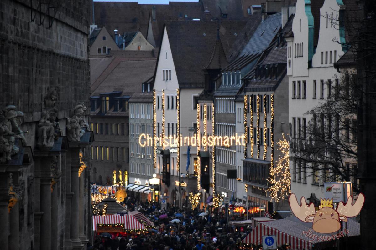
Christkindlesmarkt Nuremberg
Almost everyone has heard of him and many have seen him too. The Nuremberg Christmas market is one of the largest in Germany and we tell you about our visit.
One weekend, four different Christmas markets – an exploration tour through the Austrian Christmas market tradition
The Christmas season is just around the corner and the various Advent markets want to get visitors into the Christmas spirit with their offerings. We’ll take you on our exploration tour to the most diverse representatives of Austrian Christmas market culture.
Etwas ist schiefgegangen. Bitte aktualisiere die Seite und/oder versuche es erneut.
