
A little taste of the highlands of Iceland
Älgbert Elgson
Dieser Artikel ist auch in Deutsch verfügbar.
Þakgil is an approximately 15 kilometer long road (No.214) near Vik that leads directly from the coastal ring road to the campsite of the same name.
It is considered one of the most beautiful and easiest roads to experience the Icelandic “highland feeling”.
The path is not paved, but can be driven on with a normal car. However, it should be noted that road conditions can change significantly in bad weather and, in case of doubt, the route should only be driven with an off-road vehicle.
Useful information
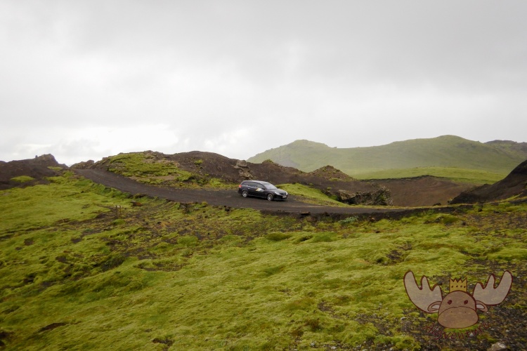
The gravel road is really nice right from the start. As soon as you leave the ring road and take road 214, a green valley awaits you, from which you then go straight up steeply and you have a great view of the valley in front of you. The journey to the campsite or to the starting point of the many hiking trails alone is worth the trip.
Road 214 can generally be driven on with normal cars, but you should keep an eye on the weather forecast for the past few days, as heavy precipitation can have a major negative impact on road conditions. We didn’t have any major problems with our micro-camper, but some volcanic stones „touched“ our underbody with their sharp edges.
Increased attention is required on the breathtaking path through an impressive landscape. Not only to capture all the impressions of nature with your eyes, but also because you always have to expect oncoming traffic on the often difficult-to-see and winding sections.
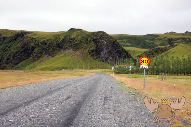
Þakgil | Die unbefestigte Straße 209 sollte mit jedem Fahrzeug zu schaffen sein, doch die Wege weiter oben können je nach den Wetterverhältnissen in unterschiedlichem Zustand sein. – The unpaved road 209 should be doable by any vehicle, but the trails further up can vary in condition depending on weather conditions. 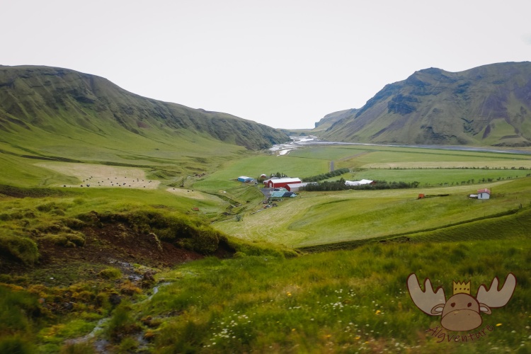
Þakgil | Nachdem man diesen Bauernhof passiert hat, glaubt man der Zivilisation entkommen zu sein. – After passing this farm, you think you have escaped from civilization. Þakgil | Weiter oben verändert sich die Straße die sich eng und verschlungen den Weg nach oben bahnt. – Further up, the road changes, which narrows and winds its way up. 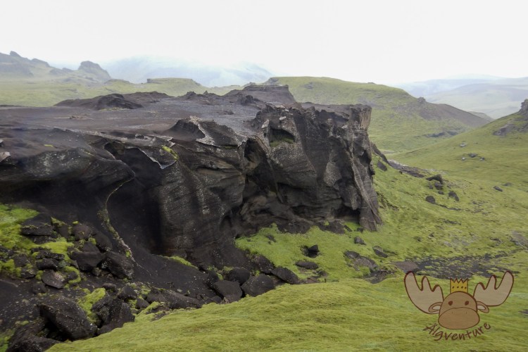
Þakgil | Beeindruckende Lavafelsformationen und unberührte Natur sind auf beiden Seiten des Weges zu sehen. – Impressive lava rock formations and untouched nature can be seen on both sides of the trail. 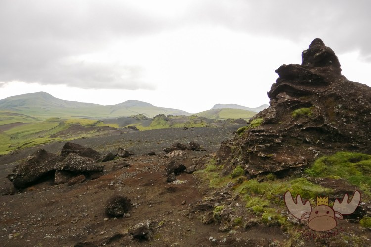
Þakgil | Die Straße nach Thakgil gilt als die einfachste Möglichkeit auch mit normalen Fahrzeugen das Hochland-Feeling einzufangen ohne dafür abenteuerliche F-Straßen in Angriff nehmen zu müssen. – The road to Thakgil is considered the easiest way to capture the highland feeling with normal vehicles without having to drive on adventurous F-roads.
At the end of the road is the Þakgil campsite. This is located at the end of the valley and is therefore perfectly protected from the weather. There are small cabins available for guests to rent, or you can park your tent or motorhome of your choice on the large green area. The lounge is located in a natural cave and can be heated.
There is a small parking lot at a junction about 800 meters below the campsite. Vehicles that are not capable of off-road use should definitely not drive further here, but visitors can park their wheels there and explore the hiking trails around Þakgil on foot. Several tours of different lengths and levels of difficulty start from there. These are signposted on site.
From the parking lot, the climb begins after about 500 meters and the hiking route to the summit of Mount Sker winds uphill in several tight curves. After about half an hour you have a fantastic view of the campsite in the gorge and the surrounding mountains.
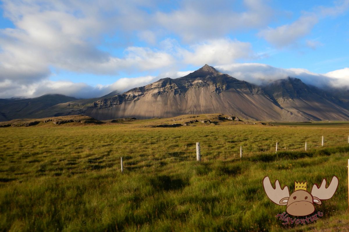
The arduous path continues uphill and is rewarded with a panoramic view far over the Myrdalssandur and to the sea. The surrounding mountain slopes are bathed in bright green and contrast with the gray-black volcanic stones.
We would rate the difficulty of the hike as “medium”. Although no alpine hiking knowledge is necessary, sufficient fitness and good footwear are the minimum requirements to be able to complete this tour. The route from the campsite to the top of Mount Sker takes about five hours (round trip) without breaks. This means you have enough time and enough provisions to take with you.
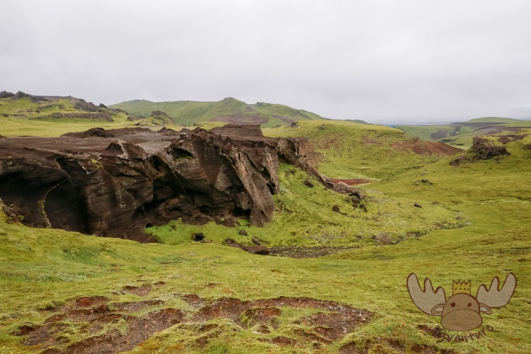
Þakgil | So weit das Auge reicht sieht man nur grüne Hänge und in der Ferne den ein oder anderen Vulkanhügel. – As far as the eye can see there are see green slopes and in the distance one or the other volcanic hill. 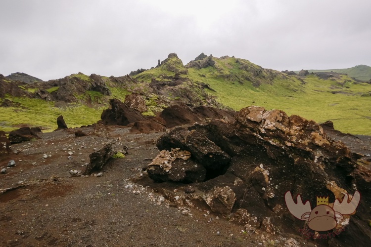
Þakgil | So viel unberührte Natur wie in Island gibt es an kaum einem anderen Ort in Europa zu finden. – There is hardly any other place in Europe where you can find as much untouched nature as in Iceland. 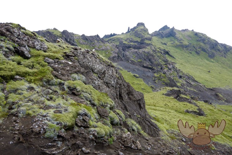
Þakgil | Die dünne Moosschicht, die sich auf dem Vulkanfelsen gebildet hat, ist äußerst empfindlich und man sollte es nicht betreten. – The thin layer of moss that has formed on the volcanic rock is extremely sensitive and should not be stepped on. 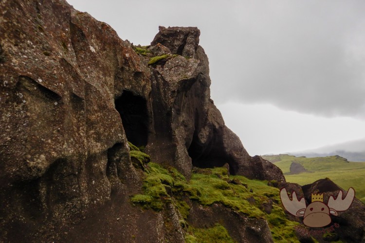
Þakgil | Viele der Felsformationen beinhalten kleine Höhlen. – Many of the rock formations contain small caves. 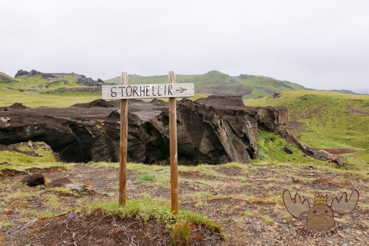
Þakgil | Der Weg zu einer begehbaren Höhlen ist mit Wegweisern markiert. – The way to a walk-in cave is marked with signposts. 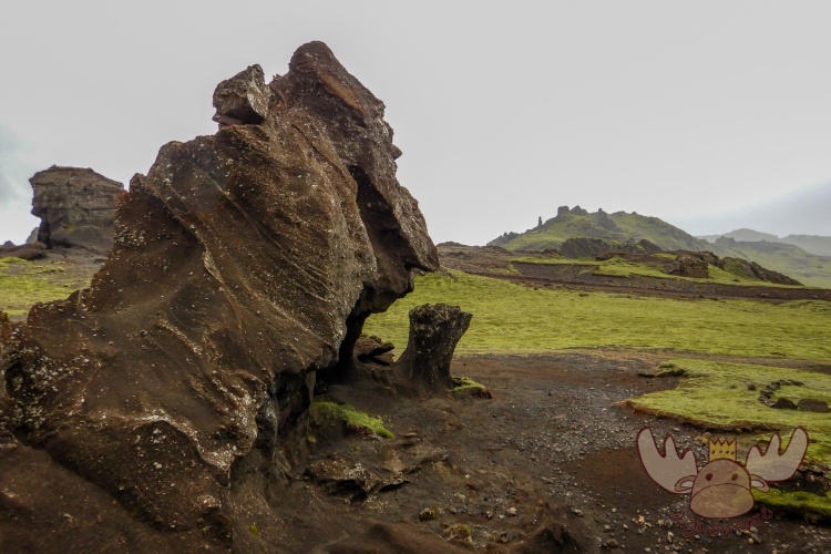
Þakgil | Wind und Wetter formten den Lavastein zu bizarren Formen. – Wind and weather shaped the lava stone into bizarre shapes.
How to get there?
The turnoff from the ring road to road 214 is about five kilometers east of Vík í Mýrdal directly at the Hotel Katla.
The road is unpaved along the entire route of around 15 kilometers and should not be used by large motorhomes or very sporty vehicles with low ground clearance.
Conclusion:
Here the journey itself is clearly the destination. The landscape appears very surreal with its strong play of colors. On the Internet we have read names such as “Valley of Mordor” or “Valley of Trolls and Elves” for Þakgil and anyone who has seen the Lord of the Rings can certainly draw certain parallels.
If you make a stopover in Vík í Mýrdal, you should definitely set aside a day and experience the route. The narrow gravel road gives travelers a glimpse of the highlands without having to travel long distances in off-road vehicles.


The South of the North – A travel report
It was that time again – we were embarking on a new adventure. After our stay with the Queen in London a few weeks earlier, we were drawn out into the world again to explore it. Many blank spots on our travel map are just waiting to be discovered by us. The general direction of…

Sunset on the Dachstein – Dinner in the Austrian Alps
The Dachstein: The jewel of the Alps attracts nature lovers and adventure seekers alike. Experience the breathtaking beauty of the Alpine landscape, from rugged rock faces to glittering glaciers. Whether you are an experienced mountaineer or a leisurely hiker – the Dachstein has something for everyone. Via ferratas, summit tours or leisurely hikes: everyone will…
In search of elves and banana plantations – A trip to Iceland
Imagine standing on the edge of a gurgling geyser while steam fogs up your glasses. Or hiking through a lunar landscape of black sand, framed by snow-capped peaks. Sound like an adventure? Iceland is just that and much more!
Join me on my adventure to Denmark, Iceland and the Faroe Islands.
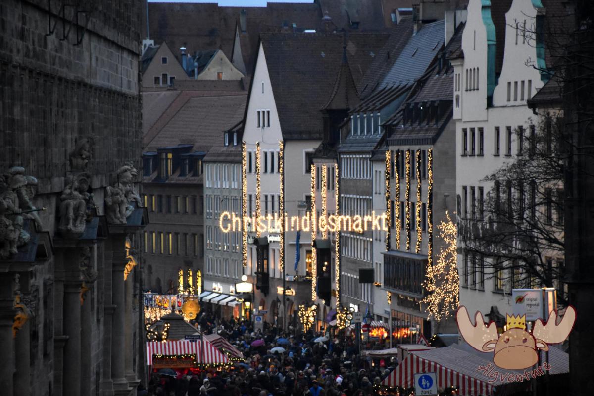
Christkindlesmarkt Nuremberg
Almost everyone has heard of him and many have seen him too. The Nuremberg Christmas market is one of the largest in Germany and we tell you about our visit.
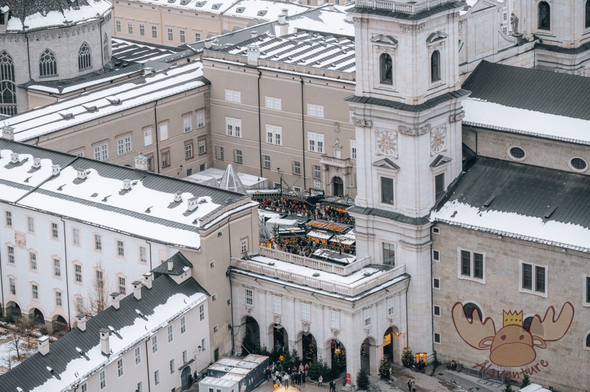
One weekend, four different Christmas markets – an exploration tour through the Austrian Christmas market tradition
The Christmas season is just around the corner and the various Advent markets want to get visitors into the Christmas spirit with their offerings. We’ll take you on our exploration tour to the most diverse representatives of Austrian Christmas market culture.
Etwas ist schiefgegangen. Bitte aktualisiere die Seite und/oder versuche es erneut.
