
A unique place in a unique landscape with plenty of history.
Älgbert Elgson

Dieser Artikel ist auch in Deutsch verfügbar.
Hardly any place in Iceland is as important as this one – historically, culturally and scenically.
This is the cradle of the Icelandic parliament Alþingi, because as early as 930 the first settlers of Iceland met once a year (assemblies with legislative and judicial functions, whereby only the law was pronounced but not directly enforced). The Republic of Iceland was proclaimed here on June 17, 1944.
Composed of the words Thing (gathering) and Vellir (fields or plain), Þingvellir is located about 52 kilometers northeast of Reykjavik near Lake Þingvallavatn on the Öxará River.

But Þingvellir National Park has more to offer. The extensive and largely deserted landscape invites travelers to explore it with hiking boots. North of Lake Þingvallavatn lies the Skjaldbreiður volcano, which is just over 1,000 meters high and 8,000 years ago emitted the amounts of lava that give the landscape its typical appearance today.
Together with the Gullfoss waterfall and the Haukadalur geysers, Þingvellir is one of the most famous sights in Iceland, the so-called Golden Circle. In Lake Þingvallavatn there is the unique opportunity to dive into the Silfragjá between the North American and Eurasian tectonic plates and touch two continents with your hands. Diving is only permitted at two sites in the national park, Silfra and Davíðsgjá.
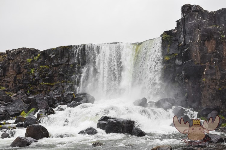
Þingvellir | Öxarárfoss 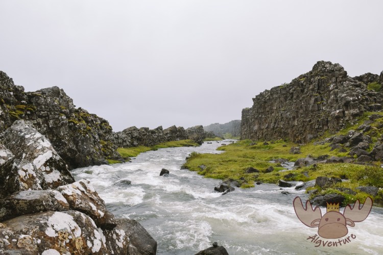
Þingvellir | Der Fluss Öxará fließt entlang der abfallenden Felsklippe. – The Öxará River flows along the sloping rocky cliff. 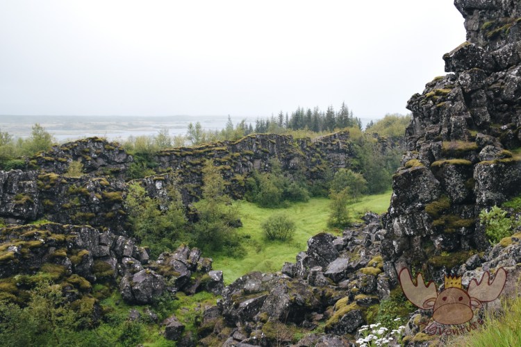
Þingvellir | Früher suchten die Menschen in diesen Tälern Schutz vor der Witterung wenn sie sich für das Alþingi versammelten. – In the past, people in these valleys sought shelter from the weather when they gathered for Alþingi. 
Þingvellir | Menschen haben oftmals die schlechte Angewohnheit Dinge und insbesondere Münzen in Brunnen oder andere Gewässer zu werfen. Dies ist natürlich ausdrücklich verboten. – People often have a bad habit of throwing things, especially coins, into fountains or other bodies of water. This is of course expressly forbidden.
The trail of history
The first settlers of Iceland held meetings with a judicial function once a year from the year 930 onwards. All male freemen (women, children and slaves were not allowed) from all over Iceland had to meet on this level. This place was also chosen because riding paths from all directions converge here and were therefore easily accessible for people. The proximity to the Öxará River also ensured an adequate supply of drinking water for people and horses and offered the opportunity to catch fish.
Remains of old walls in the Almannagjá (Allmen’s Gorge) still bear witness to these meetings today, although these remains visible today date more from the last two centuries of meetings.
But it is by no means a given that Þingvellir can be seen this way today, as the Icelanders did not always treat this wonderful place as it deserved. Inspired by the creation of national parks in the United States in the early 20th century, discussions arose about the need to preserve places that are notable and important for their beauty. At this point, the Almannagjá Gorge had already been irretrievably changed by road construction work. However, it took until 1930 until Iceland’s first national park was founded – Þingvellir National Park. Today, Þingvellir is one of Iceland’s most visited tourist attractions. Every year thousands of visitors come to get to know the country’s most important historical site and natural jewel. In 2004, Þingvellir was added to the UNESCO World Heritage List.
Useful information
The visitor center is located near the park’s main viewing point in Hakid, where a footpath leads down into the large Almannagjá fault. The large visitor parking lot can also be found there. In the visitor center you will find information about the national park as well as the “Heart of Iceland” exhibition, which uses interactive methods to bring the history and nature of Þingvellir closer to the visitor.
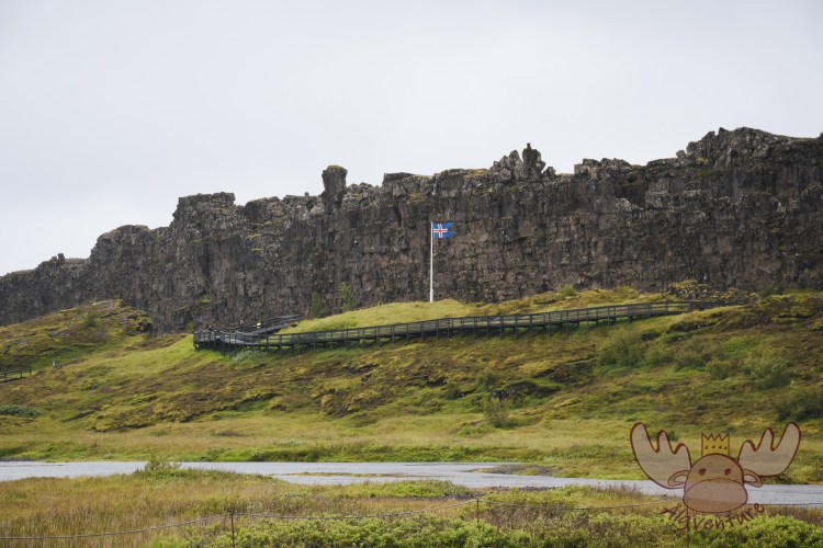
Þingvallakirkja, the church in Þingvellir, is normally closed but opens for a short time around 10:00 a.m. when a guided tour with a ranger begins from the church.
Further information can be found on the official homepage of the national park.
Þingvellir | Seit dem Beginn der Landnahme in Island haben sich die Menschen an diesem Ort getroffen um über wichtige Dinge abzustimmen. – Since the beginning of the settlement of Iceland, people have met in this place to vote on important matters. 
Þingvellir | Hier befindet sich auch Trennlinie der Eurasischen und Nordamerikanischen Tektonikplatte. Hier kann man zwischen den Kontinentalplatten wandern. – This is also the dividing line between the Eurasian and North American tectonic plates. Here you can hike between the continental plates. 
Þingvellir | Der Þingvellir-Nationalpark bietet viele Wanderrouten auf denen man durch die weitläufige Landschaft wandern kann. – Thingvellir National Park offers many hiking routes on which you can hike through the extensive landscape. 
Þingvellir | Þingvallakirkja, die Kirche in Þingvellir, ist normalerweise geschlossen und kann nur im Zuge einer Führung mit einem der Ranger des Nationalparks besichtigt werden. – Þingvallakirkja, the church in Þingvellir, is normally closed and can only be visited on a guided tour with one of the national park rangers. 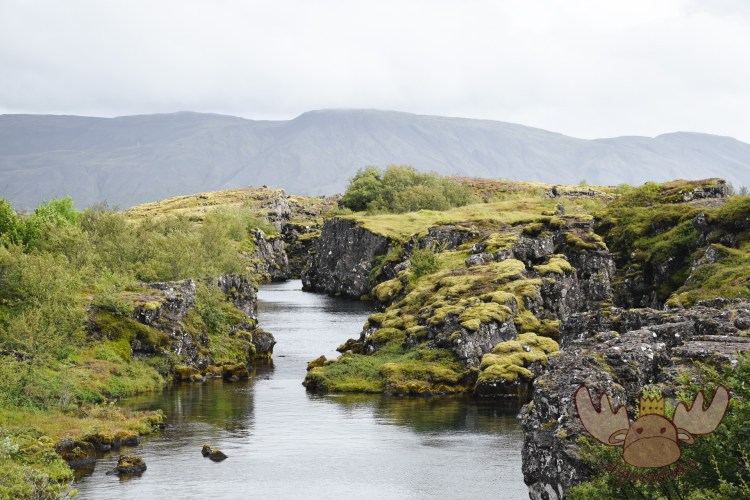
Þingvellir | Im Þingvellir-Nationalpark können Tauchgänge gebucht werden und man schwimmt zwischen den Kontinentalplatten. – In Þingvellir National Park you can book dives and swim between the continental plates.
How to get there?
Several roads lead to Thingvellir National Park, about 45 km northeast of Reykjavík.
Coming from Reykjavik, just follow road number 1 and turn onto road 36. Another way to get to Þingvellir from this direction is via the southern route following road no. 1 to Selfoss, turning onto road 35 and finally continuing on road 36. These two variants are also the route that tour operators take to take visitors along the „Golden Circle“ to several sights.
In summer you can also take road 435 to get to the national park. Unfortunately this road is closed in winter. It follows the pipeline that supplies Reykjavik with hot water from the Nesjavellir power plant in the extensive Hengill volcanic system and offers great views of Lake Þingvallavatn. The hiking trails there run past hot springs and steaming sulfur fumaroles.
There are two campsites in Þingvellir: one at the park service center in Leirar and another at Vatnskot right on the lake. No reservation is required for the campsites in Thingvellir National Park.
Conclusion:
Thingvellir National Park offers the perfect setting to get to know the landscape and history of Iceland better. The extensive hiking trails and visitor center are perfect for a day trip from the Icelandic capital Reykjavik. Depending on how much time you plan, you can see other nearby highlights as part of the Golden Circle on the same day.
Thingvellir should be part of every trip to Iceland.


The South of the North – A travel report
It was that time again – we were embarking on a new adventure. After our stay with the Queen in London a few weeks earlier, we were drawn out into the world again to explore it. Many blank spots on our travel map are just waiting to be discovered by us. The general direction of…

Sunset on the Dachstein – Dinner in the Austrian Alps
The Dachstein: The jewel of the Alps attracts nature lovers and adventure seekers alike. Experience the breathtaking beauty of the Alpine landscape, from rugged rock faces to glittering glaciers. Whether you are an experienced mountaineer or a leisurely hiker – the Dachstein has something for everyone. Via ferratas, summit tours or leisurely hikes: everyone will…
In search of elves and banana plantations – A trip to Iceland
Imagine standing on the edge of a gurgling geyser while steam fogs up your glasses. Or hiking through a lunar landscape of black sand, framed by snow-capped peaks. Sound like an adventure? Iceland is just that and much more!
Join me on my adventure to Denmark, Iceland and the Faroe Islands.
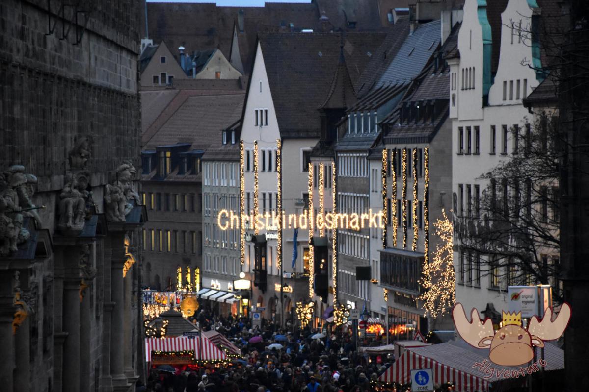
Christkindlesmarkt Nuremberg
Almost everyone has heard of him and many have seen him too. The Nuremberg Christmas market is one of the largest in Germany and we tell you about our visit.
One weekend, four different Christmas markets – an exploration tour through the Austrian Christmas market tradition
The Christmas season is just around the corner and the various Advent markets want to get visitors into the Christmas spirit with their offerings. We’ll take you on our exploration tour to the most diverse representatives of Austrian Christmas market culture.
Etwas ist schiefgegangen. Bitte aktualisiere die Seite und/oder versuche es erneut.
