
Two waterfalls that are worth seeing and not just because of their size!
Älgbert Elgson

Dieser Artikel ist auch in Deutsch verfügbar.
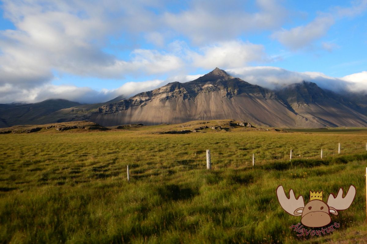
In the eastern part of Iceland, near the town of Egilsstaðir, is Lake Lagarfljót. Before the „Hengifossá“ river flows into it, it makes its way through the country’s rock layers and in some places falls down a few meters. This spectacle is very impressive at Hengifoss, one of the highest waterfalls in Iceland, and Litlanesfoss, a two-tiered waterfall surrounded by rare, hexagonal basalt columns.
The trail of history
The two waterfalls Hengifoss and Litlanesfoss, like many waterfalls, were created during the last ice age. Large glaciers covered the land and the weight of these and later the meltwater caused the land to sometimes have deep gradients. Over time, the water found a way through the rock and formed narrow gorges in places where the rock layers were not hard enough. In the other places where the water met rock that was too hard, waterfalls overcome these height differences. In the case of Hengifoss, the water of the Hengifossá River, a tributary of the Lagarfljót, falls approximately 128 meters into the depths, making it one of the highest waterfalls in Iceland. Particularly spectacular because the rock behind the waterfall consists of different layers and those made of volcanic ash appear reddish due to the iron oxide particles they contain. A little further downstream, the Hengifossá has to overcome another smaller difference in altitude. The Litlanesfoss is a two-tiered waterfall with a total height of 30 meters and is particularly worth seeing because the water makes its way between impressive basalt columns that are up to 20 meters high – which also gives it the name Stuðlabergsfoss, i.e. basalt column fall.

Useful information
Hengifoss is visible from the road passing by, but not Litlanesfoss. Starting from the parking lot, where there are also public toilets, a hike of approximately one hour leads to the destination. There are a few steps to overcome in the first few meters of the path, but after that the hike leads along a natural path to the first intermediate destination: Litlanesfoss. This slightly smaller but no less impressive waterfall is somewhat hidden and can only be admired if you walk towards the edge of the cliff. Litlanesfoss is about halfway and after another climb the path leads relatively flat to Hengifoss. In the last few meters you have a great view of the waterfall and you can clearly see the different rock layers, and the surrounding landscape is also beautiful to look at.
The total length of the route is around 2.5 kilometers and the path can be a bit rocky at times, but the hike should be manageable for almost everyone with suitable footwear. However, due to the steps at the beginning and the partly rocky path, we do not recommend the hike with strollers or for people with limited mobility. The way back is the same as the way up and is therefore always downhill.


How to get there?
From the nearest larger town, Egilsstaðir, it is approximately 35 kilometers to reach the parking lot where the hike starts. The site cannot be reached by public transport, but there are some parking spaces available for your own vehicle – and it’s even free! Parking spaces can become scarce in high season, so either arrive early or late or be patient.
Conclusion:
A very nice hike that, with a total of 2 hours of walking time, is not too long and is therefore easy to manage even for less athletic people. At the beginning you are immediately rewarded with a view of the surrounding area and afterwards the hike is simply a pleasure due to the picturesque landscape. On top of that, Hengifoss and Litlanesfoss are beautiful to look at and although there are countless waterfalls on the island, they are still unique.


The South of the North – A travel report
It was that time again – we were embarking on a new adventure. After our stay with the Queen in London a few weeks earlier, we were drawn out into the world again to explore it. Many blank spots on our travel map are just waiting to be discovered by us. The general direction of…

Sunset on the Dachstein – Dinner in the Austrian Alps
The Dachstein: The jewel of the Alps attracts nature lovers and adventure seekers alike. Experience the breathtaking beauty of the Alpine landscape, from rugged rock faces to glittering glaciers. Whether you are an experienced mountaineer or a leisurely hiker – the Dachstein has something for everyone. Via ferratas, summit tours or leisurely hikes: everyone will…
In search of elves and banana plantations – A trip to Iceland
Imagine standing on the edge of a gurgling geyser while steam fogs up your glasses. Or hiking through a lunar landscape of black sand, framed by snow-capped peaks. Sound like an adventure? Iceland is just that and much more!
Join me on my adventure to Denmark, Iceland and the Faroe Islands.
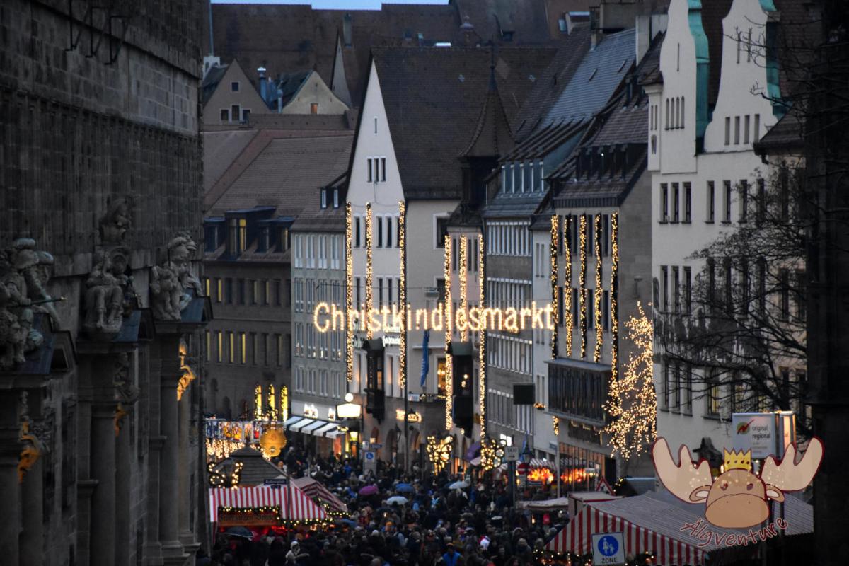
Christkindlesmarkt Nuremberg
Almost everyone has heard of him and many have seen him too. The Nuremberg Christmas market is one of the largest in Germany and we tell you about our visit.
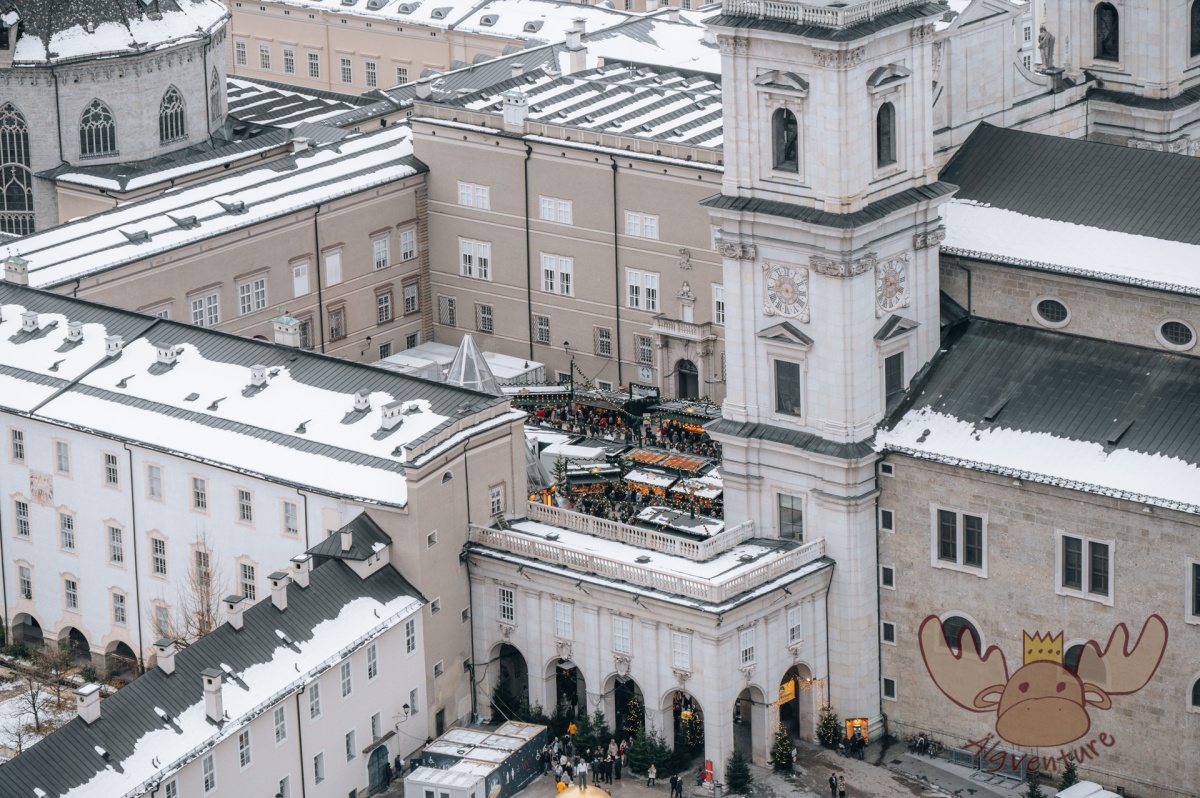
One weekend, four different Christmas markets – an exploration tour through the Austrian Christmas market tradition
The Christmas season is just around the corner and the various Advent markets want to get visitors into the Christmas spirit with their offerings. We’ll take you on our exploration tour to the most diverse representatives of Austrian Christmas market culture.
Etwas ist schiefgegangen. Bitte aktualisiere die Seite und/oder versuche es erneut.
